Reserves and Honeypots
Rushy Mead
This small reserve is an Essex Wildlife Trust site, bordering the river just south of Bishop's Stortford. It includes wetland, reedbed and wet woodland habitats.
Thorley Wash
This is Herts & Middlesex Wildlife Trust’s newest reserve, and can be reached from the towpath near Spellbrook. It is a Site of Special Scientific Interest because of the diversity of wildflowers it supports. Work is currently underway to remove encroaching scrub and restore the site, as well as improving public access.
Sawbridgeworth Marsh
This area of reedbed, wetland, wet woodland and ponds is extremely important for nesting birds and for insect life. Is it owned jointly by Essex and Herts & Middlesex Wildlife Trusts and can be accessed from Hallingbury Road.
Maymeads Marsh
This small reserve of wetland, grassland and pond is extremely important for a range of bird species, including the elusive bittern. There is an observation hide giving good views of the pond.
Marshgate Springs
This area of marshland and mature woodland has lovely displays of bluebells in spring.
Pishiobury Park
Pishiobury Park is an area of historic parkland with scattered woodland, a natural spring, pond and areas of hawthorn scrub. As well as being valuable for many plants and animals, it is one of the most popular places in the Stort valley for families, with excellent picnic spots! Longhorn cattle help to maintain the diversity of grassland. It is located just south of Sawbridgeworth on the A1184.
For more information, and to download a leaflet, click here.
Hunsdon and Eastwick Meads
This is an area of common land between the River Stort and the Stort Navigation, spanning the Hertfordshire/Essex border near Roydon. It is one of the finest surviving unimproved grassland sites in the two counties, and of huge importance for plants, insects and wintering birds.
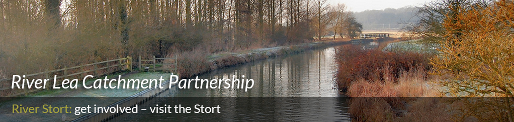
Public access
Footpaths
There is excellent public access to the Stort Navigation. A public footpath runs all the way along the Navigation from Bishops Stortford to the confluence with the Lea.
For much of this stretch the path is part of the ‘Stort Valley Way’, a 28-mile circular walk around Harlow and Sawbridgeworth.
For information on walking in the Stort valley, and to download a leaflet, click here.
In the upper Stort, access to the river is focused on Clavering. A riverside path runs south from Clavering for about a mile, until the river crosses the road leading to the village of Berden. There is also some access to the river to the north of the village – please refer to an OS map for exact details (Explorer Map 194).
Transport links
A regular train service runs through the Stort valley, connecting Stansted Mountfichet, Bishop's Stortford, Sawbridgeworth, Harlow and Roydon.
